Help concerning Temperature Map
Posted by jgodeke on
URL: http://imagej.273.s1.nabble.com/Help-concerning-Temperature-Map-tp3684660.html
Hello!
I´ve spend some time with imagej in the last weeks because i have a difficult task to solve.
Now that i have some results, i´m not that happy with i would like to know if someone knows a better solution.
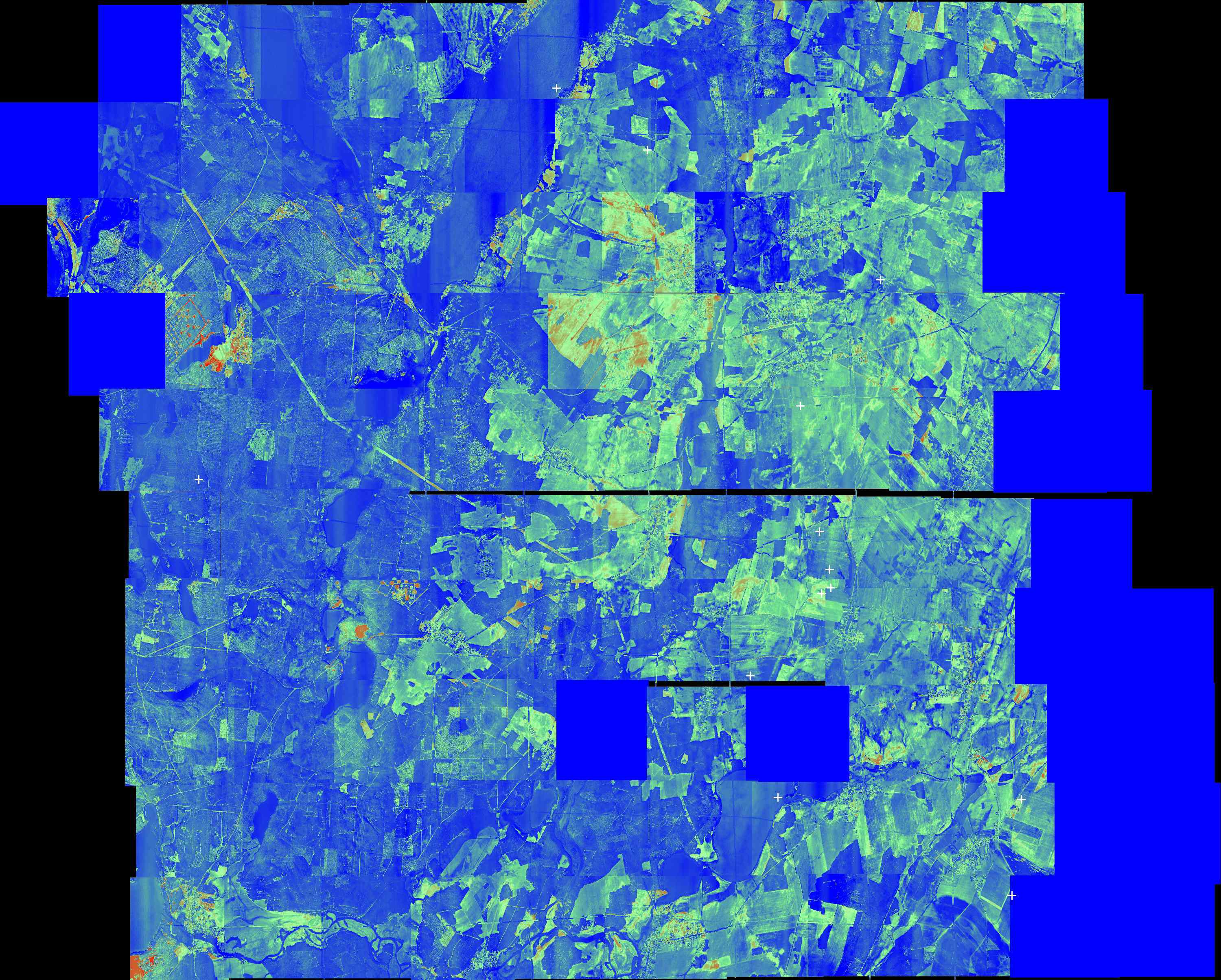
This is the source temperature map. Aim is to segment connected areas with the same/similar temperature to define the average size. Actual temperature of a "cell" is not of concern.
This is my solution:
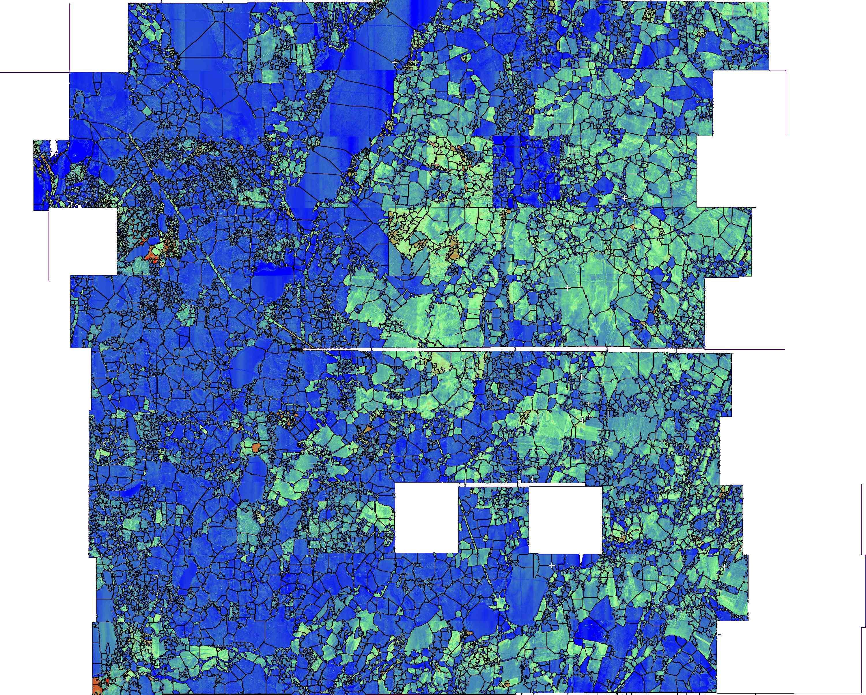
edit:(I despeckled the image)
I selected red green and blue areas via color thresholding separately and used watersheding to receive the outlines which i copied over the actual image in photoshop. The average area is 182 pixels which "should" be rather something like 120 pixels. The lake in the top middle-left is segmented though i don´t know why and some other areas too.
I would be very happy if someone knows a plugin like watershed which produces better results!
Thank you,
Jonathan
URL: http://imagej.273.s1.nabble.com/Help-concerning-Temperature-Map-tp3684660.html
Hello!
I´ve spend some time with imagej in the last weeks because i have a difficult task to solve.
Now that i have some results, i´m not that happy with i would like to know if someone knows a better solution.
This is the source temperature map. Aim is to segment connected areas with the same/similar temperature to define the average size. Actual temperature of a "cell" is not of concern.
This is my solution:
edit:(I despeckled the image)
I selected red green and blue areas via color thresholding separately and used watersheding to receive the outlines which i copied over the actual image in photoshop. The average area is 182 pixels which "should" be rather something like 120 pixels. The lake in the top middle-left is segmented though i don´t know why and some other areas too.
I would be very happy if someone knows a plugin like watershed which produces better results!
Thank you,
Jonathan
| Free forum by Nabble | Edit this page |